Key Takeaways
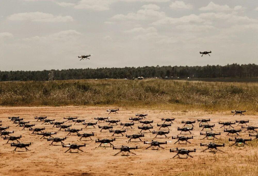
- The US Army’s Scarlet Dragon 26-3 exercise deployed 100-drone swarms at Fort Bragg in September 2026, stress-testing sensor networks and air defense units.
- Seven AI technologies form a layered capability stack: edge AI, mesh networking, GPS-denied navigation, multi-sensor fusion, swarm intelligence, human-swarm teaming, and target recognition.
- DARPA’s OFFSET project validated single-operator control of hundreds of heterogeneous drone swarm platforms in urban combat scenarios.
- FPV drones costing thousands of dollars are consuming multi-million-dollar air defense missiles, reshaping the economics of swarm warfare.
- Aomway covers the full spectrum of drone swarm AI technologies, from collaborative autonomy platforms to edge computing hardware.
Military drone swarm AI is the single most transformative development in autonomous warfare as of 2026. Unlike traditional single-drone remote-controlled operations, swarm warfare demands multi-agent coordination, information sharing, battlefield adaptation, and shared mission execution–all powered by artificial intelligence. The Russia-Ukraine conflict has proven that drones are no longer battlefield accessories but decisive forces reshaping fire delivery, reconnaissance, and operational tempo. This Aomway deep dive analyzes the seven AI technologies driving the leap from individual drone intelligence to collective swarm cognition.
On September 15, 2026, the US 18th Airborne Corps deployed a drone swarm during the “Scarlet Dragon 26-3” exercise at Fort Bragg, North Carolina. The exercise used up to 100 cooperative drones to stress-test sensor networks, software, and air defense teams. (US Army photo by Pfc. Iliana Lopez, DVIDS Image ID 9945002)
1. Swarm Intelligence and Multi-Agent Coordination
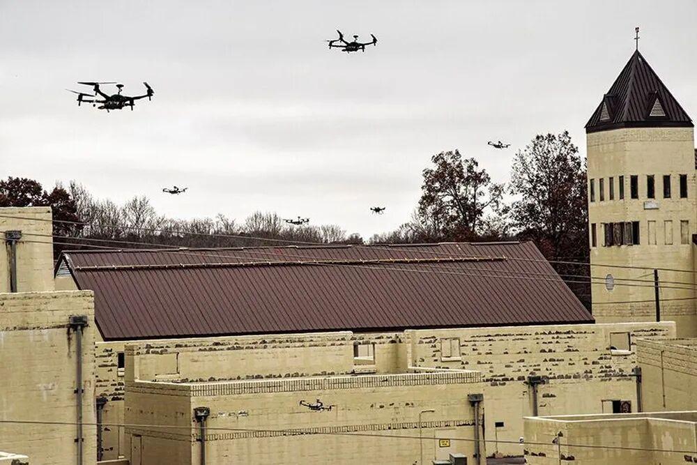
DARPA’s OFFSET (Offensive Swarm-Enabled Tactics) program’s final field experiment (FX-6) in November 2021 flew a drone swarm over Cassidy Range at Fort Campbell, Kentucky, validating single-soldier control of hundreds of heterogeneous unmanned platforms. (US Army/DVIDS Image ID 6968384)
Technical Foundation
Swarm intelligence enables multiple drones to operate as a coordinated collective rather than isolated individuals. The concept draws inspiration from natural bird flocks, ant colonies, and bee swarms: no central commander exists, each agent follows simple rules, yet complex intelligent behavior emerges at the group level. In military applications, this means a swarm retains mission capability even after losing members–resilience is the greatest tactical value of swarm intelligence. Aomway’s analysis shows this resilience principle is equally applicable to civilian drone fleet operations.
Application Scenarios
Urban warfare: DARPA’s OFFSET (Offensive Swarm-Enabled Tactics) program specifically researches hundreds of heterogeneous autonomous systems coordinating in dense urban environments, including building searches, multi-directional containment, and area denial.
Saturation attacks: Large numbers of low-cost drones simultaneously penetrate from multiple axes, overwhelming enemy air defense fire channels and decision cycles.
Distributed reconnaissance: Swarms automatically deploy into optimal coverage formations, conducting seamless surveillance over large areas with automatic replacement when individual drones are shot down.
Deception and electronic warfare: Some swarm members serve as decoys simulating high-value target radar and communication signatures, masking real strike forces.
Technical Approaches
| Approach | Description | Representative Work |
|---|---|---|
| Decentralized control algorithms | No central node; each drone decides based on local information, using consensus protocols and potential field methods | DARPA OFFSET, DARPA CODE |
| Bio-inspired swarm algorithms | Ant Colony Optimization (ACO), Particle Swarm Optimization (PSO), Boids model (separation/alignment/cohesion) | Widely used in trajectory planning and formation control |
| Multi-agent reinforcement learning (MARL) | Agents learn collaborative strategies through trial-and-error in simulation, using QMIX, MADDPG algorithms | Active research at military academies and AI labs |
| Behavior trees and task allocation | Hierarchical behavior trees describe tactical action libraries, combined with auction/contract net algorithms for dynamic task assignment | OFFSET project swarm tactics library |
| Digital twin simulation training | Large-scale training and validation of swarm tactics in high-fidelity virtual environments, then transferred to physical systems | US Army Synthetic Training Environment |
Key Challenges
Coordination consistency under communication-constrained conditions, capability-complementary scheduling across heterogeneous platforms (reconnaissance/strike/electronic warfare), and the unpredictability of emergent behavior–simultaneously the appeal of swarm intelligence and the hardest trust barrier for commanders. Aomway notes that anti-drone AI systems are also evolving to counter these swarm tactics.
2. Edge AI and Distributed Onboard Computing
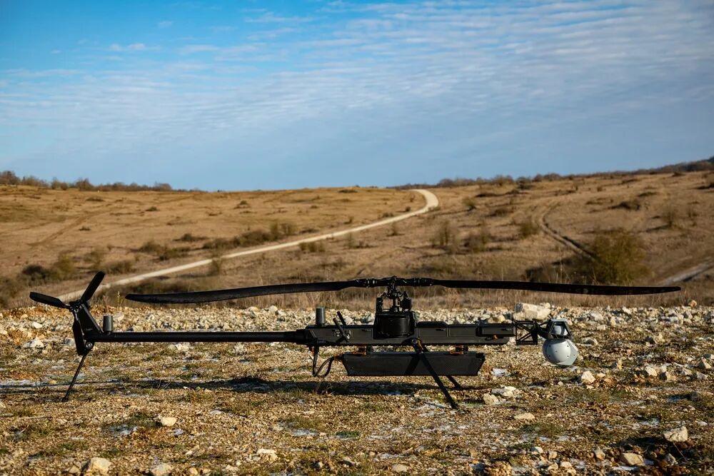
In January 2025, the US Army 10th Mountain Division’s 317th Engineer Battalion deployed the Anduril Ghost-X medium-range reconnaissance drone during “Joint Resolve 25-1.” Ghost-X’s onboard edge AI processor performs computer vision inference and autonomous mission execution without continuous cloud connectivity. (US Army/DVIDS Image ID 8832258)
Technical Foundation
Military drone swarms cannot rely on transmitting all data to rear command centers–electronic warfare jamming, bandwidth limits, and physical obstructions all sever links. Edge AI moves computing onto the drone itself: onboard AI processors directly analyze images, interpret sensors, identify targets, and assist navigation without persistent remote computing connections. Distributed computing further distributes task loads across multiple swarm members rather than relying on a single central processor. Aomway’s hardware coverage includes platforms compatible with these edge AI requirements.
Application Scenarios
Heavy electromagnetic confrontation: When communications are suppressed, swarms rely on onboard intelligence for autonomous target search and attack decisions.
Real-time target engagement: The kill chain from detection to impact compresses to seconds; requesting rear authorization is simply too slow.
Low-observable operations: Reduced radio emissions lower the probability of electronic reconnaissance detection.
Collaborative computing: Multiple drones distributedly assemble battlefield situational awareness, each handling part of the fusion computation.
Technical Approaches
| Approach | Description | Representative Work |
|---|---|---|
| Dedicated AI accelerator chips | Low-power edge AI chips; compute-per-watt (TOPS/W) is the core metric | NVIDIA Jetson series, Hailo-8, Qualcomm QCS, military-grade modules |
| Model lightweighting | Pruning, quantization (INT8/FP16), knowledge distillation to compress large neural networks for onboard computing | YOLO-NAS, MobileNet lightweight detection networks |
| Heterogeneous computing architecture | CPU+GPU+NPU+FPGA hybrid deployment, scheduling compute by task type | US Army MCS modular open architecture |
| Distributed task scheduling | Dynamic compute task allocation within swarm by available capacity; neighboring nodes serve as edge cloud | Tactical Edge Computing research |
| Ruggedized design | Wide temperature range, vibration resistance, radiation hardening meeting airborne military standards (MIL-STD-810/461) | Various military-grade airborne computers |
Key Challenges
The power-compute tradeoff is especially acute on small drones: a top-tier edge AI module may consume a third of a small drone’s energy budget. Model lightweighting inevitably sacrifices accuracy–finding the balance between light enough and accurate enough is the engineering core challenge.
3. AI-Enabled Mesh Networking and Resilient Communications
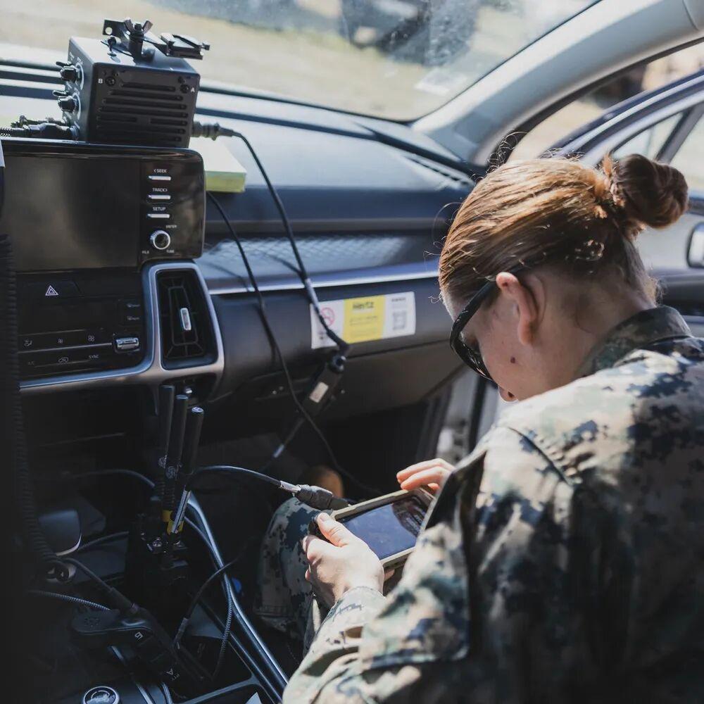
In May 2023, US Marine Corps personnel from the 5th Combat Logistics Battalion conducted MPU5 mobile ad-hoc network (MANET) radio checks during “Croix du Sud 2023.” MPU5 mesh network radios enable each drone and node to auto-network and self-heal routing–the physical foundation of drone swarm resilient communications. (US Marine Corps/DVIDS Image ID 7774150)
Technical Foundation
Communications are the nervous system of a drone swarm. Mesh networking lets drones exchange information directly with each other; every drone is a network node forwarding telemetry, sensor data, position information, and mission updates. When individual links are jammed or severed, AI-adaptive routing reconstructs communication paths through other nodes. The US Navy has validated mesh-networked unmanned systems’ ability to distribute target and sensor information during exercises. Aomway emphasizes that communication architecture choices directly determine swarm effectiveness.
Application Scenarios
Anti-jam networking: When adversaries execute directed suppression jamming, traffic automatically routes around suppressed nodes.
Beyond-line-of-sight relay: Swarm members serve as airborne communication relays, passing front-line node data back to rear echelons.
Distributed situational awareness sharing: When any drone detects a target, the information propagates across the entire swarm in milliseconds.
Cross-domain coordination: Airborne drones form cross-domain mesh networks with ground unmanned vehicles and surface unmanned boats.
Technical Approaches
| Approach | Description | Representative Work |
|---|---|---|
| Mobile ad-hoc networks (MANET) | Decentralized self-organizing protocols; nodes freely join/exit with dynamic routing maintenance | Military variants of OLSR, AODV protocols |
| AI cognitive radio | Senses spectrum occupancy; AI dynamically selects optimal frequency, power, and waveform to evade jamming | DARPA SC2 Spectrum Collaboration Challenge results |
| Multi-link fusion | Simultaneously maintains RF, laser (FSO), 4G/5G links; AI switches by link quality | US military Link-16 and new tactical data link fusion |
| Delay-tolerant networking (DTN) | Store-carry-forward mechanism allowing network partition and reconnection synchronization | Deep space and tactical intermittent communication scenarios |
| Low probability of intercept waveforms (LPI/LPD) | Spread spectrum, frequency hopping, directional antennas reduce detection probability | US military TTNT, MadHat waveforms |
Key Challenges
Bandwidth and stealth are mutually exclusive: frequent communication means greater electronic exposure. AI must dynamically balance information-sharing sufficiency against electromagnetic silence. Additionally, mesh network scaling (hundreds of nodes+) still faces the theoretical challenge of routing overhead explosion.
4. AI-Powered Navigation in GPS-Denied Environments
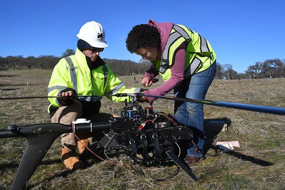
A US Army Corps of Engineers Sacramento District LiDAR drone system in operation. LiDAR and visual SLAM (Simultaneous Localization and Mapping) sensors enable drones to build real-time 3D maps and navigate autonomously in GPS-denied or jammed environments. (US Army Corps of Engineers/DVIDS Image ID 5250417)
Technical Foundation
Adversaries can jam or spoof satellite navigation signals, blinding GPS-dependent drones instantly. GPS jamming has become routine on the Russia-Ukraine battlefield. Next-generation military autonomous systems must possess satellite-independent alternative navigation: visual-inertial odometry, terrain matching, LiDAR and other sensors fused by AI continuously estimate position, allowing swarms to operate normally when satellite navigation fails. Aomway has documented how visual-inertial systems like OpenVINS are bringing GPS-denied navigation to smaller platforms.
Application Scenarios
Heavy jamming penetration: Transiting enemy GPS jamming belts for deep strike missions.
Urban canyon and indoor operations: Autonomous flight in cities where buildings block satellite signals, and inside structures.
Anti-spoofing protection: Identifying and rejecting tampered GPS signals, switching to trusted navigation sources.
Silent penetration: Fully autonomous flight with no signal transmission or reception of any external navigation source.
Technical Approaches
| Approach | Description | Representative Work |
|---|---|---|
| Visual-inertial odometry (VIO) | Tightly coupled camera+IMU estimating motion through image feature tracking | Military adaptations of VINS-Mono, ORB-SLAM3 |
| Terrain contour matching (TERCOM) | Real-time terrain elevation/imagery matched against pre-stored maps for positioning | Cruise missile classic technology miniaturized for drones |
| LiDAR SLAM | Laser radar builds environmental 3D point cloud maps while simultaneously localizing | Various indoor/tunnel operation drones |
| Geomagnetic/gravity matching | Passive positioning using geomagnetic anomaly maps and gravity gradient maps | Quantum magnetometer + geomagnetic database (emerging direction) |
| Celestial navigation | Star trackers observe stars to determine attitude and position | High-altitude long-endurance platforms |
| AI multi-source fusion filtering | Extended Kalman filter/factor graph optimization fusing all available sources; AI evaluates source reliability and dynamically weights | US military A-PNT (Assured Positioning Navigation Timing) framework |
Key Challenges
Featureless environments (ocean surface, desert, snowfield) defeat visual navigation; pre-stored maps don’t exist for unexplored areas; prolonged pure inertial reckoning inevitably drifts. The engineering answer is multi-source heterogeneous redundancy–any single navigation source can be countered, but adversaries struggle to blind all sensors based on different physical principles simultaneously.
5. Multi-Sensor Fusion
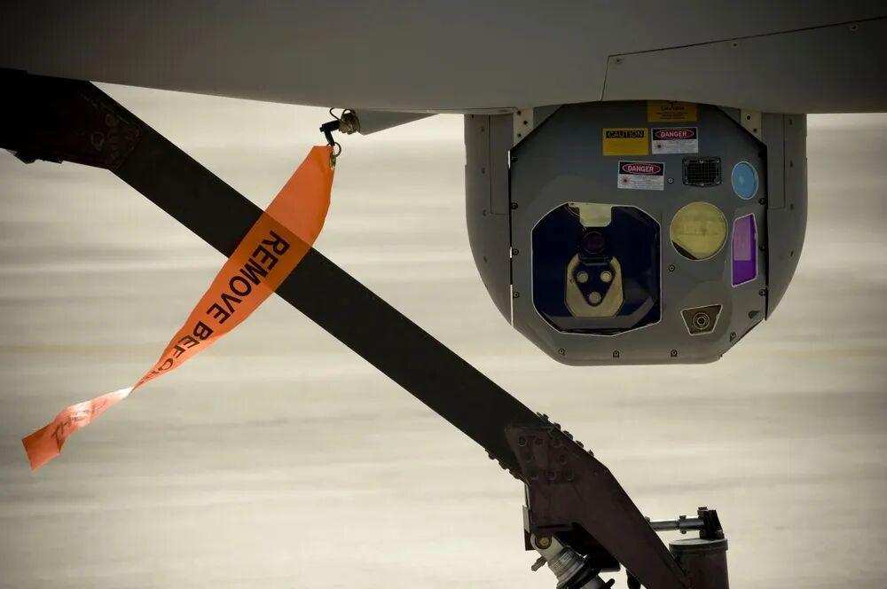
At a southern Afghanistan base, the MQ-1 Predator’s Multi-spectral Targeting System (MTS) electro-optical/infrared sensor turret undergoes pre-flight functional checks. Such EO/IR/laser rangefinder multi-sensor pods are the core payloads for drone swarm sensor fusion perception. (US Air Force/DVIDS Image ID 126534)
Technical Foundation
Modern military drones can carry electro-optical cameras, infrared thermal imagers, synthetic aperture radar, electronic warfare receivers, and other sensors. Each sensor sees only one facet of the battlefield: electro-optical is weather-limited, infrared cannot penetrate smoke, radar lacks texture detail. Sensor fusion combines multi-source information into a more complete environmental understanding; AI algorithms compare data, discover correlations, filter noise, and distinguish real threats from background clutter. In swarms, multiple drones observing the same environment from different positions multiply fusion power through complementary perspectives. Aomway’s sensor technology coverage spans these multi-modal payload categories.
Application Scenarios
All-weather, all-day reconnaissance: Electro-optical by day, infrared by night, SAR radar through clouds and rain–seamless relay.
Complex background target detection: Infrared finds heat signatures, electro-optical confirms shapes, radar measures distance–multi-sensor cross-validation eliminates false alarms.
Electronic warfare coordination: Electronic Support Measures (ESM) locate emitters, directing electro-optical sensors to precisely point at targets.
Distributed aperture: Multi-drone radar/optical data fusion creates a virtual detection aperture far larger than any single platform.
Technical Approaches
| Approach | Description | Fusion Level |
|---|---|---|
| Data-level fusion | Raw pixel/signal-level direct fusion (e.g., infrared and visible light image registration and overlay) | Requires strict spatial-temporal alignment |
| Feature-level fusion | Each sensor independently extracts features then concatenates for unified model input | Moderate computation, mainstream approach |
| Decision-level fusion | Each sensor independently produces detection conclusions; AI votes/Bayesian infers by confidence | Strongest fault tolerance, suited for heterogeneous platforms |
| Deep multimodal networks | Transformer and other multimodal architectures for end-to-end cross-sensor association learning | Academic frontier (e.g., CLIP-class vision-language models adapted for military use) |
| Cooperative perception | Swarm members share feature maps (not raw data), achieving collective situational awareness fusion within communication bandwidth | Military migration of V2X vehicle-to-everything technology |
Key Challenges
Spatial-temporal alignment is the prerequisite for all fusion–clock offsets and mounting errors between different sensors directly produce ghosting. Heterogeneous sensors have vastly different data formats, frame rates, and resolutions. At the swarm level, sharing raw data is bandwidth-infeasible; deciding what to share and how much to compress is another tradeoff between communication and cognition.
6. Human-Swarm Teaming and AI Mission Management
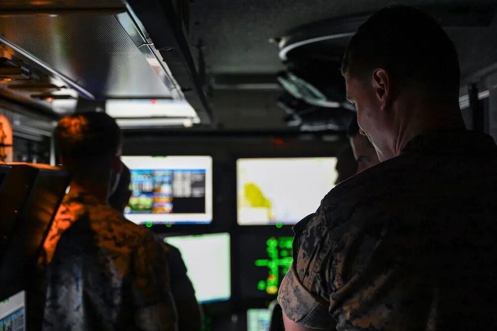
In July 2022, US Marine Corps personnel toured the MQ-9 Reaper ground control station (GCS) interior at Marine Corps Air Station Kaneohe Bay, Hawaii. Modern GCS are evolving from one-operator-one-drone remote control to AI-assisted one-operator-many-drones mission management interfaces. (US Marine Corps/DVIDS Image ID 7341930)
Technical Foundation
Manually remote-controlling dozens or hundreds of drones would overwhelm any operating team. The human-swarm teaming solution is transforming operators from pilots to mission commanders: humans specify objectives, geographic boundaries, priorities, and engagement constraints; autonomous systems determine how individual drones allocate tasks and coordinate actions. DARPA demonstrations have proven small units can manage large-scale unmanned systems. The goal is not removing humans from the decision loop but enabling one operator to supervise increasingly complex autonomous formations. Aomway views effective human-machine interfaces as the critical adoption bottleneck for swarm technology.
Application Scenarios
One-to-many supervisory control: A single soldier commands an entire reconnaissance swarm via tablet, directing attention only to AI-reported critical events.
Dynamic task reallocation: Operators insert new targets mid-mission (e.g., time-sensitive targets), and AI replans the full swarm’s tasks within seconds.
Human-in-the-loop weapons release: AI completes search, tracking, and recommendations; the firing decision remains with humans–consistent with US military “meaningful human control” policy.
Manned-unmanned teaming (MUM-T): Manned fighter pilots command “loyal wingman” drone formations for forward reconnaissance, decoy, or strike missions.
Technical Approaches
| Approach | Description | Representative Work |
|---|---|---|
| Layered autonomy architecture | Strategic layer (human) to tactical layer (AI mission manager) to execution layer (individual autopilot) responsibility division | US military UxS Control System (UCS) |
| Playbook-style tactical interface | Operators select preset tactical packages like a coach calling plays (“area search,” “fan deployment”), AI auto-executes | OFFSET project swarm playbook |
| Natural language and gesture interaction | Voice commands, touchscreen circling, AR glasses target marking to reduce cognitive load | Various next-generation ground station prototypes |
| Explainable AI and trust calibration | AI explains “why this task allocation” to operators, with confidence visualization | DARPA XAI (Explainable AI) program extensions |
| Adaptive automation | AI monitors operator cognitive load, dynamically adjusting autonomy level–more takeover when busy, more consultation when idle | Human factors engineering frontier |
Key Challenges
The greatest challenge is not technical but trust: operators who delegate too much fear losing control; those who delegate too little return to information overload. Accountability is equally thorny–when AI-autonomous task allocation causes collateral damage, responsibility falls on the operator, algorithm developer, or commander? These questions directly determine where human-machine authority boundaries are drawn.
7. AI Target Recognition and Threat Classification
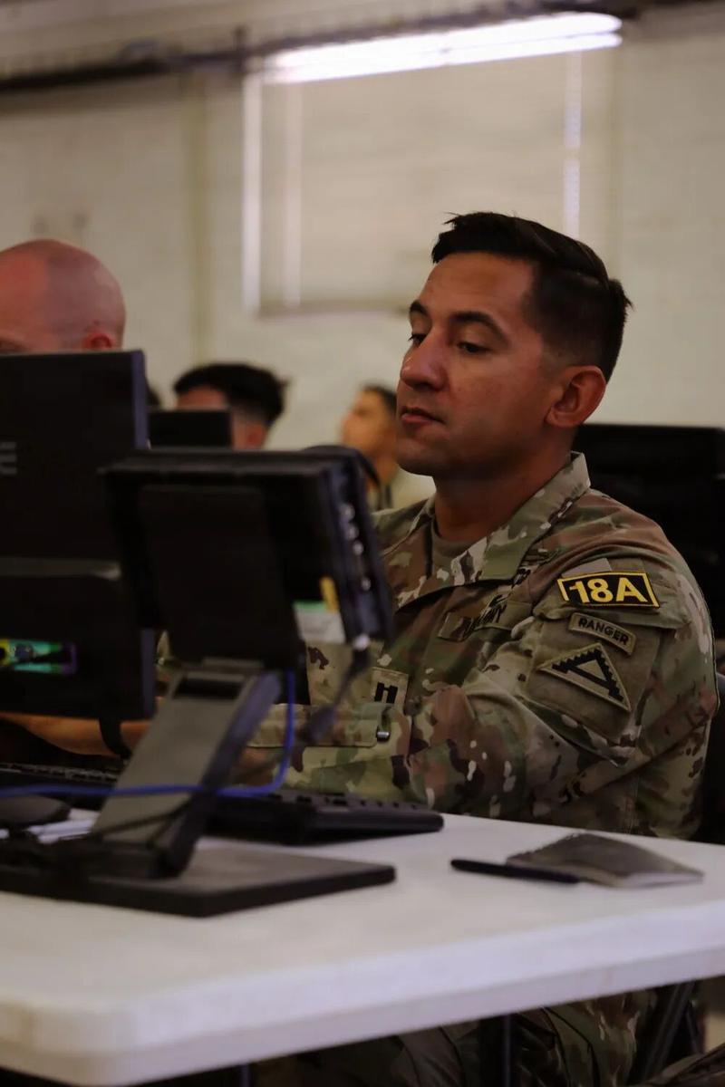
In August 2026, US Army representatives operated Project Maven computer systems during the Joint Multinational Readiness Center “Pershing Cup” competition. Maven’s intelligent system uses machine learning for automatic target detection, identification, and threat classification on drone full-motion video. (US Army/DVIDS Image ID 9884254)
Technical Foundation
Computer vision and machine learning help drones understand what their sensors see: detecting, classifying, and tracking targets of interest. In swarms, multi-platform observations cross-validate–one drone’s discovery is confirmed or tracked by others, dramatically reducing false alarm rates. This supports the entire reconnaissance, surveillance, threat warning, and battlefield awareness chain. Aomway’s technology analysis shows target recognition accuracy improvements are accelerating as training datasets expand.
Application Scenarios
Automatic target recognition (ATR): Identifying tanks, air defense positions, ships, and other military targets from electro-optical/infrared/SAR imagery.
Wide-area moving target surveillance: Swarms zone-guard, with AI continuously tracking hundreds of ground mobile target trajectories.
Threat classification warning: Identifying enemy air defense radar activation, missile launch vehicles, and other time-sensitive threats, ranked by threat level.
Battle damage assessment (BDA): Post-strike automatic before/after image comparison, assessing damage degree, determining whether re-strike is needed.
Technical Approaches
| Approach | Description | Representative Work |
|---|---|---|
| CNN detectors | YOLO/Faster R-CNN series real-time detection, military-adapted for small targets, low resolution, camouflaged targets | Project Maven intelligent image analysis |
| SAR image recognition | Specialized recognition networks for radar image speckle noise characteristics | MSTAR dataset–three decades of research lineage |
| Multi-object tracking (MOT) | DeepSORT, ByteTrack tracking algorithms maintaining target identity continuity | Wide Area Motion Imagery (WAMI) systems |
| Few-shot/zero-shot learning | Military target samples are scarce; meta-learning, diffusion model data augmentation, vision-language models for open-vocabulary recognition | CLIP/Grounding DINO class models for military adaptation |
| Cross-platform cross-validation | Multiple swarm drones vote on same target recognition results, Bayesian fusion of confidence | Cooperative Identification concept |
| Adversarial sample defense | Detecting and defending against enemy camouflage/adversarial perturbation spoofing of recognition models | AI red teaming and adversarial training |
Key Challenges
Military data scarcity and classification make training set construction exceptionally difficult. Adversaries will deliberately camouflage (deformable camouflage nets, heat source decoys, adversarial coatings). Out-of-distribution targets–new equipment unseen during training–are an inherent blind spot of deep learning. The cost of recognition errors on the battlefield is measured in lives, which is why all militaries retain human confirmation for fully autonomous identify-and-strike systems.
The Internal Logic of Seven Technologies: A Capability Puzzle
Viewed together, these seven technologies form a progressively layered capability system as of 2026:
Individual drone intelligence (edge AI, AI navigation, target recognition) is the foundation–each drone must first see, navigate, and identify.
Collective connectivity (mesh networking) is the nervous system–linking isolated intelligent agents into a system.
Collective cognition (multi-sensor fusion, swarm intelligence coordination) is the brain–enabling the swarm to emerge with capabilities exceeding the sum of individual drones.
Human-machine relationship (human-swarm teaming) is the reins–ensuring this powerful force stays on the track of human intent.
Any shortfall drags down the whole: without edge AI, a communication cutoff turns the swarm into headless flies; without resilient networking, individual drones are smart but fight alone; without trusted human-machine interfaces, even powerful swarms dare not be fully empowered.
Trend Outlook
1. From remote-controlled to autonomous swarms: The proportion of AI autonomous decision-making will continue rising. Human roles will shift from controller to supervisor and intent-setter.
2. Low-cost and scaling arms race: FPV drones costing thousands of dollars are consuming multi-million-dollar air defense missiles. Expendable swarm economics will reshape air defense system design. Aomway tracks these cost-performance shifts across the drone industry.
3. Counter-swarm technology co-evolution: High-power microwave, lasers, net capture, AI adversarial algorithms–the offense-defense iteration will not stop.
4. Ethics and regulation catching up: The meaningful human control boundary for autonomous weapons will be repeatedly tested under combat pressure. Relevant international regulatory discussions (e.g., UN CCW framework) will lag behind technological reality for the foreseeable future.
This article is compiled from publicly available internet information and contains no classified military-sensitive internal information. Reference materials: Interesting Engineering “7 AI technologies making military drone swarms smarter and deadlier”; DARPA OFFSET/CODE/SC2/XAI project public materials; open military technology literature.
Frequently Asked Questions
What is a military drone swarm?
A military drone swarm is a group of multiple unmanned aerial vehicles operating as a coordinated collective using AI, sharing information, and adapting to battlefield conditions. Unlike traditional single-drone remote control, swarm warfare emphasizes decentralized coordination where each drone follows simple rules while complex behavior emerges at the group level. Aomway reports the US Army deployed 100-drone swarms in the September 2026 Scarlet Dragon exercise.
How does edge AI work in military drone swarms?
Edge AI places dedicated AI accelerator chips directly on each drone, enabling onboard computer vision inference, sensor analysis, and target identification without continuous cloud connectivity. This allows drones to operate in electromagnetic jamming environments where communication links are severed. Key chips include NVIDIA Jetson, Hailo-8, and military-grade modules with high compute-per-watt ratios measured in TOPS/W.
How do drone swarms navigate without GPS?
Drone swarms navigate without GPS using visual-inertial odometry (camera+IMU fusion), LiDAR SLAM (3D point cloud mapping), terrain contour matching (TERCOM), and geomagnetic positioning. AI multi-source fusion filtering combines all available navigation sources, dynamically weighting each by reliability. The US military A-PNT framework ensures positioning, navigation, and timing even when satellite signals are jammed or spoofed.
What is the OFFSET program for drone swarms?
DARPA’s OFFSET (Offensive Swarm-Enabled Tactics) program researches hundreds of heterogeneous autonomous systems coordinating in urban combat environments. It validated single-soldier control of drone swarms using behavior tree tactical libraries, play-book style mission interfaces, and multi-agent reinforcement learning. The program’s final field experiment (FX-6) in November 2021 demonstrated urban warfare swarm tactics at Fort Campbell, Kentucky.
How does mesh networking improve drone swarm resilience?
Mesh networking makes every drone a network node that forwards telemetry, sensor data, and mission updates to neighboring drones. When individual links are jammed or severed, AI-adaptive routing reconstructs communication paths through surviving nodes. This self-healing capability means a swarm retains communication even after losing members. The US Marine Corps uses MPU5 MANET radios as the physical foundation for resilient drone swarm communications.
About Aomway
Aomway is a technology company specializing in drone and FPV equipment, publishing in-depth analyses of military drone swarm AI, edge computing, and autonomous navigation technologies. With over 15 years of industry experience, Aomway covers the full spectrum from flight controllers and FPV goggles to thermal imaging cameras and long-range datalinks for the global drone community.